If you don't have Google Earth on your computer you'll need to install it. Just go to http://earth.google.com/ and click the green "download" button on the right.
OK, now comes the fun part. Click on this link:
http://tomerceg.googlepages.com/prescott.kmz
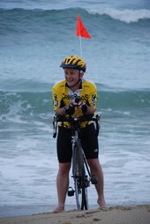
Google Earth should launch, and yesterday's ride should show up. The green circles are the photos I took during yesterday's ride, located exacted where I took them. How cool is that!
You may see a blue Bounding Box in the area where I rode. That's the last technical glitch we're trying to fix. Hopefully we'll figure that out in the next couple of days. In the meantime, here's how to get rid of it.
- on the left side of the screen find the section called "places".
- There is an item under "temporary places" called Prescott. That is todays GPS data. Under that is a checkbox item called "tracks". Click the "+" next to "tracks" (don't remove the check mark)
- "ACTIVE.LOG" should show up. Click the "+" mark next to it.
- You'll see "Bounding Box" now. Click where the check mark is next to Bounding Box. The check mark should go away and the blue box on the screen should disappear.
Go ahead and click on any of the photos and they will pop up on the screen.
You can also rotate the view to get a more horizontal view of the terrain. Try it, it's pretty amazing. On the upper right hand corner of the page you'll see a circle. Move your mouse over it and you'll see a horizonal bar at the top. Click and hold the far right-hand side of the bar and the entire screen will rotate giving you a completely different perspective. Try playing around with the views. It's really fun stuff.
When you're done Google Earth will ask you if you want to save your temporary spaces. If you say yes you'll start building a route of the entire trip, complete with all the photos.
I'll get the first few days rides posted in the next couple of days.
I'd like to thank Tim Reynolds for all his tireless efforts in figuring out how to set all this up. He spent hours playing with different software packages trying to figure out how to make the GPS unit, the camera, and Google Earth all play nicely together. Thanks Tim!

3 comments:
That is really COOL. The desert flowers are so pretty too. Have fun today.
Hey I got this working. VERY cool, and a fun way to see your pictures.
The thing about seeing it from above is that it does seem REALLY far.
Glad the ride is going well!
Way to Go Tom! Your Illinois In-Laws (or out-laws)are rooting for you. You seem to have gotten rid of all your estrogen from last weekend.Thanks again for all your help. Stay safe and enjoy! Can't wait to see your progress daily.
Julie and Steve
Post a Comment